Opening 780 miles of river across two states, the Midwest Conservation Blueprint
- Date:
- Author: Gigi Otten, USFWS Public Affairs Specialist
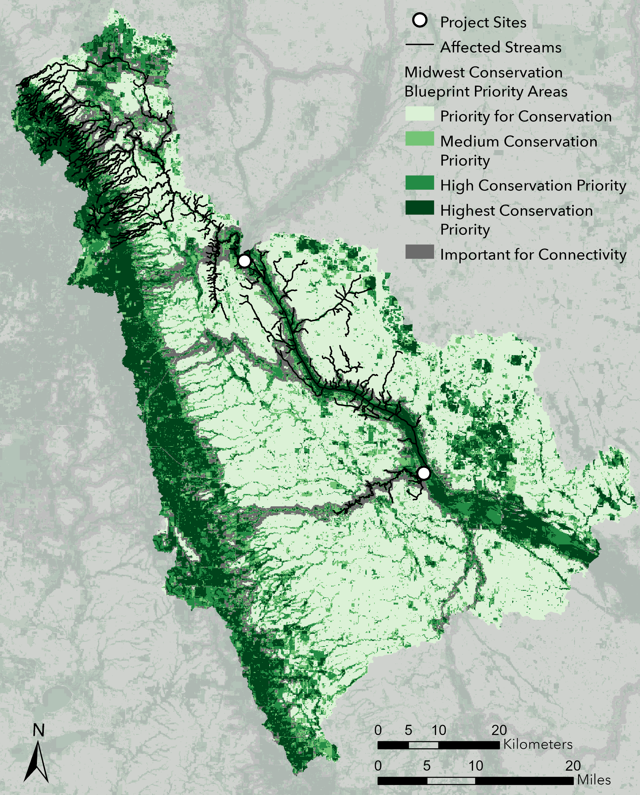
A portion of the Midwest Conservation Blueprint highlights the affected project area. Map by Rachael Carlberg/USFWS.
Writing grant applications, coordinating among multiple partners and adapting to ever-changing project details can be overwhelming experiences for many of us. In spring of 2024, one group of partners realized success as they activated the assistance of the Midwest Landscape Initiative and used the Midwest Conservation Blueprint as evidence to help attract funding for their conservation project. Read on to learn how this project used the initiative and how you can do the same.
The Midwest Landscape Initiative is a regional collaborative of various conservation partners, including our agency represented by Science Applications staff. The initiative’s goal is to identify shared conservation and management priorities that require the development of scalable collaborative solutions to achieve healthy, functioning ecosystems.
As April came to a close, the Upper Minnesota River Watershed District was awarded $3.3 million as a National Fish Passage Project from the Bipartisan Infrastructure Law. Along with six other partnering organizations, The Sisseton Wahpeton Oyate of the Lake Traverse Reservation, Minnesota Department of Natural Resources and South Dakota Game Fish and Parks have been heavily involved. The project area, just upstream of Big Stone National Wildlife Refuge, includes traditional fish spearing grounds where the Sisseton Wahpeton Oyate identified barriers to be removed and the major public recreation area of Big Stone Lake. In total, the project covers an impressive 756,480 acres, removes two barriers and opens 780 miles of upstream tributaries to the Minnesota River.
With the work happening at the intersection of Minnesota and South Dakota, the Midwest Landscape Initiative was a natural collaborator. In this case, the initiative worked with the project partners to provide a magnified frame of the Midwest Conservation Blueprint which specified the levels of conservation priority at the project’s geographic location and an analysis which indicated how this project would support human and natural communities in the midwest.
The spatial ecologist for the initiative, Rachael Carlberg, said, “It is great to see this project funded, and to see a clear example of how the blueprint can be successfully used in support of funding applications!” The initiative specializes in borderless conservation, and by working with multiple partners to conserve nature, the initiative can provide consultation, facilitation and support for projects who reach out. Reach out to Rachael and other initiative staff to see how they can support your project.
Access, use and get to know others who use the Midwest Conservation Blueprint.